Practical possibilities and Benefits

Practical possibilities and Benefits

Providing seismic comparisons with downhole measurements

  • abnormally high pressure zones
  • non-structural hydrocarbon deposits
  • direct forecast of hydrocarbon deposits

Audit of oil fields with complex geological structure

  • identification of decompression zones in target horizons, open fracturing associated with faults
  • permeability detection
  • identification of areas with improved reservoir properties
  • 4D seismic monitoring

Search for non-structural hydrocarbon deposits

  • search for porous-fractured reservoirs
  • substitution zone search

Seismic support for horizontal drilling

  • building a high spatial resolution velocity model
  • identification of areas with enhanced drainage properties

List of Benefits and Applications of the RTH Method

RTH benefits

  • The spatial resolution of migration images is 3-6 times higher compared to conventional depth migration before summation
  • Velocity tomography with a spatial resolution of up to 1 meter
  • Lack of near-surface layer problem
  • Stability RTH to sparse regular and sparse irregular seismic systems of receivers and sources
  • Simultaneous and independent calculation of all known seismic attributes, such as: RTM, AVO, Dip, Opening Angle, azimuthal and spatial scattering anisotropy and even more than 50 new, previously unknown attributes

RTH applications

  • Identification of zones of decompaction (heterogeneity) of target horizons that are associated with faults, cracks, increased permeability and improved reservoir properties
  • Seismic base for high precision geosteering in horizontal well drilling
  • Ensuring efficient comparison of RTH attributes with GIS data due to the equivalent spatial resolution of RTH and GIS data
  • Identification of promising areas for exploration and drilling
  • Assessment of the current state of oil fields with a complex geological structure based on high-precision traditional and new RTH attributes

Conclusions

1.The RTH method, as in optical holography, “accurately” captures information about the amplitudes and phases of a scattered and time-reversed seismic wave using some “reference” wave — the stage of decomposition of the RTH method.

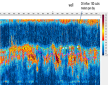
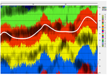
2.This information is stored in the VDCIG repository (Vector Domain Common Image Gathers). The construction of seismic attributes is based on a direct statistical estimation of the dataset from VDCIG — the stage of synthesis of the RTH method.

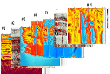
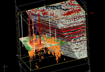
3.The RTH method allows you to simultaneously obtain various voxel-based attributes of high spatial resolution (up to 1 meter) such as reflectors, diffractors, dip angles, scattering anisotropy, azimuthal anisotropy, AVO, etc.

4.The method provides velocity  tomography with ultra high spatial resolution.

5.The RTH method requires more processing power than the conventional RTM depth migration method, but significantly less than the high frequency FWI methods.

6.Method RTH is stable  to sparse regular and sparse irregular seismic systems of receivers and sources  and so special RTH seismic more cost effective then conventional seismic

7.Near-surface layer problem is absent for RTH method

Reflected and scattered wave field components